1,324 m
Elevation
167 m
Prominence
Coordinates
Unknown — the Finnish highpoint is a gentle slope on Halti's shoulder
First Ascent
About Halti
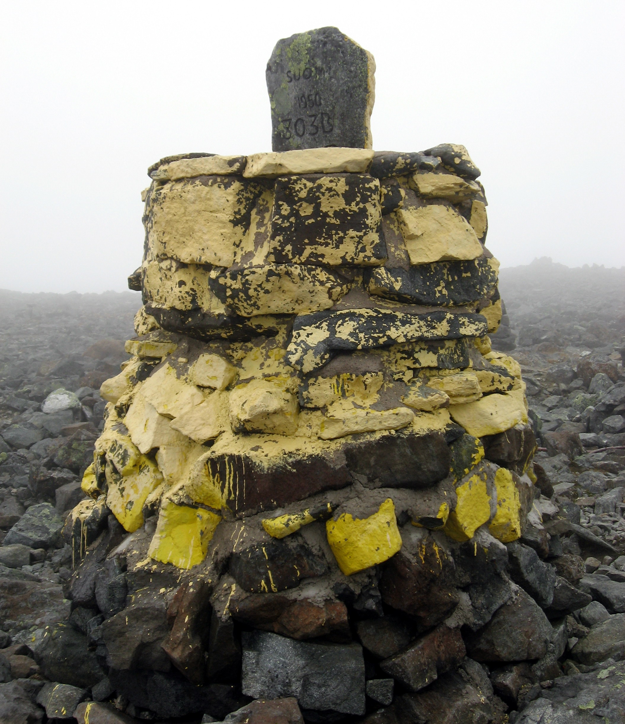
Halti is the highest point in Finland at 1,324 m, but it is not a summit: the Finnish highpoint sits on a broad shoulder of the Halti massif, while the actual peak (Háldičohkka, 1,365 m) lies just across the border in Norway. Getting there is the real challenge — a 55 km hike each way from Kilpisjärvi through open Lapland fell country, usually done over four to five days using the free wilderness huts along the Kalottireitti trail.
Technically, Finland's highest point is a gentle slope on Halti at 1,324 m, while the actual summit (1,365 m) is in Norway. A remote multi-day hike through Lapland wilderness.
Also known as: Halti, Haltitunturi, Háldičohkka, Halditsohkka, Halti fell.
Climbing Halti: route, season and difficulty
- How long it takes
- 4–8 hours round trip from the standard trailhead
- Do you need a guide?
- No guide needed. A marked trail, decent fitness and a map or GPS track are enough for most fit hikers.
- Best season
- Usually late June to mid-September.
- Terrain & gear
- Marked walking trails with a sustained but non-technical climb. Hiking boots, waterproofs, water, food and navigation. Nothing technical.
The route from Kilpisjärvi, day by day
There is a shortcut worth knowing: a summer boat service across Kilpisjärvi to Koltaluokta trims roughly 10 km off each end of the walk, which turns a five-day trip into a comfortable four. Some hikers also approach from the Norwegian side via Guolasjávri, which reaches the summit in a single long day but skips the part of the trip most people come for.
- ▸Day 1: Kilpisjärvi to Saarijärvi hut, about 16 km of easy birch-forest and fell walking.
- ▸Day 2: Saarijärvi to Kuonjarjoki hut, about 15 km, with the first big open fell sections.
- ▸Day 3: Kuonjarjoki to Meekonjärvi or Halti hut, about 15-20 km, crossing streams that can run high after rain.
- ▸Day 4: Halti hut to the Finnish highpoint and, if you want the true summit, 40 minutes more into Norway.
- ▸Days 5-6: retrace the trail, or arrange a boat shuttle across Kilpisjärvi lake to cut the last stretch.
Huts, gear and Arctic conditions
The Kalottireitti huts are open wilderness huts maintained by Metsähallitus: free, unlocked, with bunks, a wood stove and no booking. They can fill on August weekends, so carry a tent regardless. There is no mobile coverage over most of the route and no resupply after Kilpisjärvi.
Weather is the deciding factor. This is Arctic fell country above the treeline, where wind-driven rain near freezing is normal in August and snow is possible any month. Navigation across the plateau in fog needs a map, compass and GPS rather than a phone alone.
| Finnish highpoint | 1,324 m (true summit 1,365 m, in Norway) |
|---|---|
| Distance | About 55 km each way from Kilpisjärvi |
| Typical duration | 4-5 days round trip |
| Difficulty | Non-technical, but remote and weather-exposed |
| Season | Late July to early September |
| Accommodation | Free open wilderness huts plus a tent as backup |
📝 Martin's Personal Note
Watch out for mosquitoes in summer! We drove up from Gothenburg and hiked in the 24-hour sun from the Norwegian side.
Frequently Asked Questions
What is the highest mountain in Finland?
The highest mountain in Finland is Halti, at 1,324 meters above sea level.
How long does it take to climb Halti?
Allow 4–8 hours round trip from the standard trailhead. Times vary with fitness, conditions and which trailhead you start from.
Can you climb Halti without a guide?
No guide needed. A marked trail, decent fitness and a map or GPS track are enough for most fit hikers.
When is the best time to climb Halti?
The usual season is late June to mid-September. Outside that window expect snow, storms or closed access.
What gear do you need for Halti?
Hiking boots, waterproofs, water, food and navigation. Nothing technical.
How high is Halti?
Halti stands at 1,324 meters (4,344 feet).
Where is Halti located?
Halti is located in Finland, within the Scandinavian Mountains.
Has Martin climbed Halti?
Yes — Martin summited Halti in 2023 as part of his country highpointing project.
How high is Halti and is it a real mountain?
Finland's highpoint on Halti is 1,324 m. It is a rounded fell shoulder rather than a peak — the true 1,365 m summit is in Norway, a short walk further along the ridge.
How long does the hike to Halti take?
Most hikers take four to five days round trip: roughly 55 km each way from Kilpisjärvi, with overnights in the wilderness huts. Fast, light parties do it in three.
Do you need a permit or guide to hike to Halti?
No permit and no guide. Finland's everyman's right covers hiking and wild camping, and the open wilderness huts are free and first-come, first-served.
When is the best time to hike Halti?
Late July to early September. Before that there is heavy snow and flooded river crossings; the mosquito peak is mid-July; autumn colours in early September are the highlight of the year.
Nearby highpoints of similar height
Highpointing lists to explore
Climbed Halti? Add it to your tick list
Log the summits you've climbed, build bucket lists, follow other adventurers and watch your country count grow. Free, and built by adventurers for adventurers.
- Tick ascents with dates & photos
- Track challenge lists & goals
- Follow adventurers, share trips